.
.
.
Next Wednesday, August 19, the Advisory Committee on Electoral Districts (the panel of judges that will draw Anaheim’s first-ever district maps) will meet for the first of its final set of meetings with the public. All of the proposed maps are now present; it’s time for them to choose — or to construct their own. We’ll discuss all of the Anaheim Districting submissions over the next week.
This long post, with all of these graphics and tables, may look daunting. It shouldn’t be. This first installment is simply intended to get the 25¼ maps (the “¼” one is for only one district) together in one easily referenced place. You’re going to treat it sort of like your reference encyclopedia — except that it’s a collection of maps and associated stats.
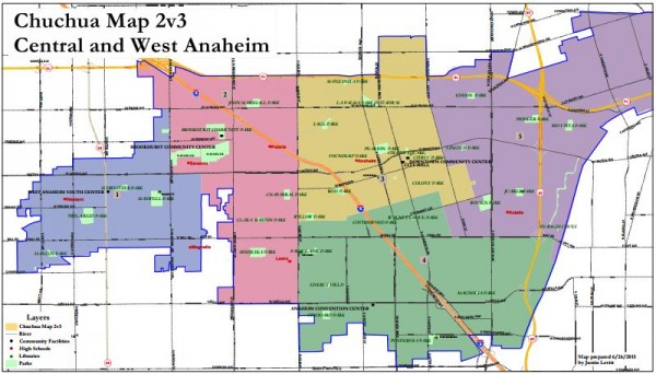
The first map presented is the “Chuchua Map 2v3” (on which I did most of the technical work, based on deep knowledge about Anaheim provided by Brian Chuchua and other long-term residents). It appears first not because its ours, or even because a lot of people (including strangers) seem to like it — but because it really does seem simple and straightforward. It’s therefore a good base from which to analyze other maps. (It’s also not the one that I most favor; that would be the “Chuchua Map 4.”)
After that come the Demographer’s Four Maps, then the 15 other “full maps” (mostly only of the west and central portions of the City, as Anaheim Hills is pretty much set) provided by citizens, and finally the map of the South Anaheim district provided by the Ponderosa community. We’ll refer back to this post a whole lot in the weeks to come — and it will be updated if additional citizen maps are provided by Friday’s deadline for citizen submissions.
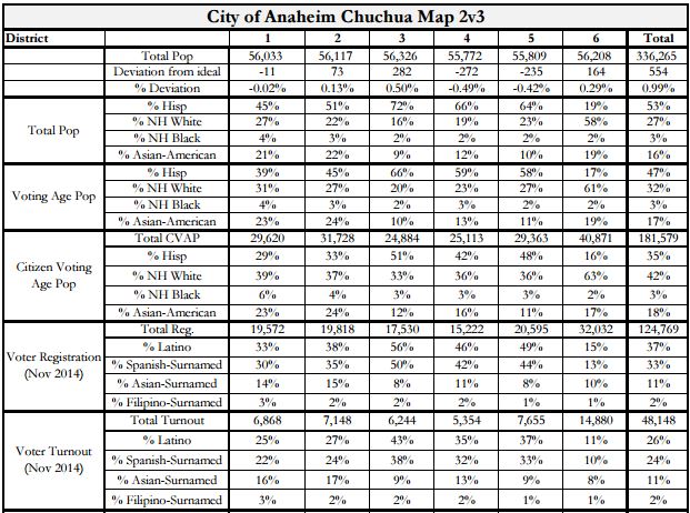
Chuchua Map 2v3 — Map and Stats
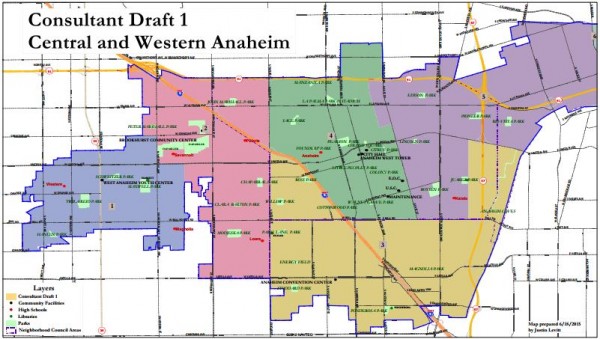
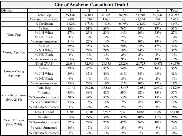
Consultant Map 1 — Map and Stats
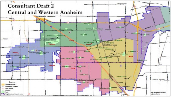
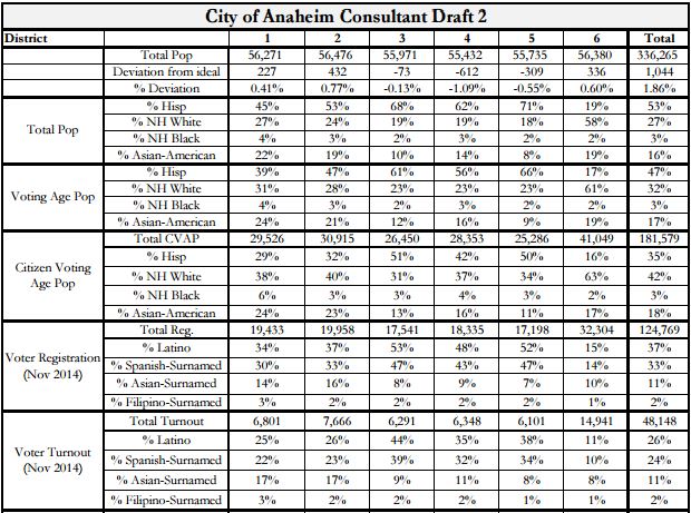
Consultant Map 2 — Map and Stats
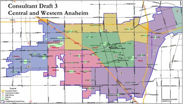
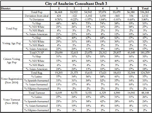
Consultant Map 3 — Map and Stats
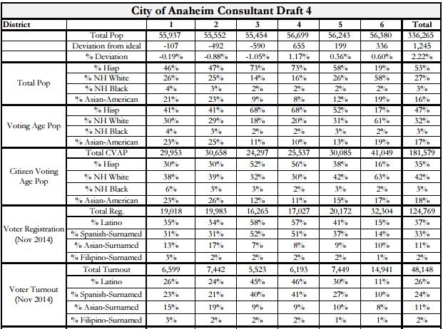
Consultant Map 4 — Map and Stats

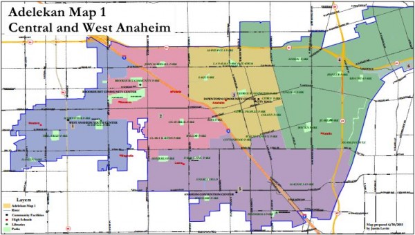
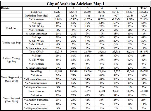
Adelekan Map 1 — Map and Stats
Bengochea Map — Whole City Map, Map, and Stats

Brown Map — Map and Stats


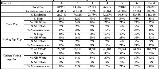
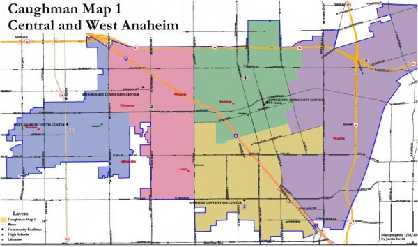
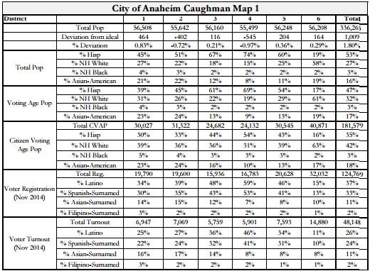
Caughman Map — Map and Stats
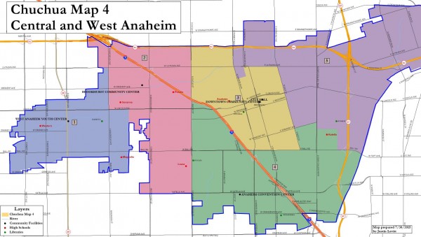
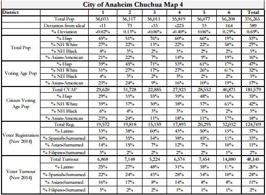
Chuchua (Hybrid) Map 4 — Map and Stats
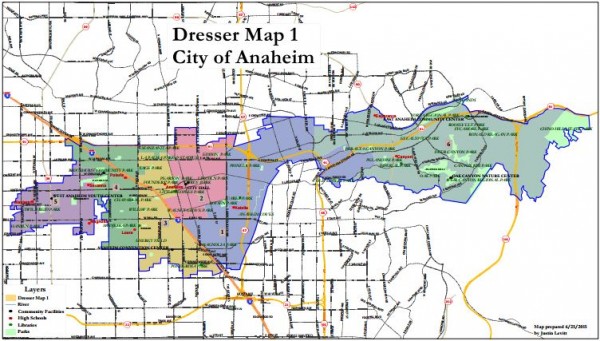
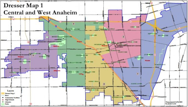
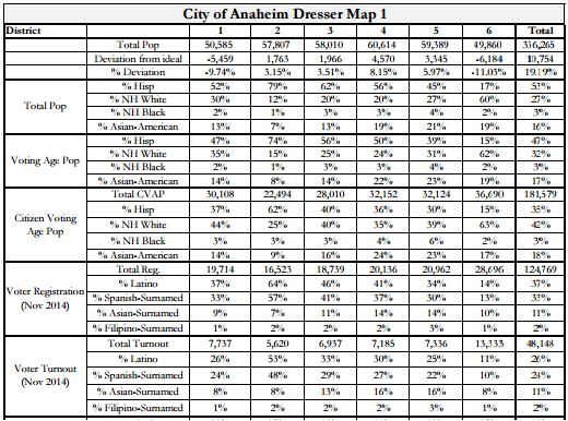
Dresser Map — Whole City, Map, and Stats
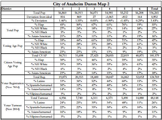
Duron Map 2 — Map and Stats

Gagne Map — Map and Stats


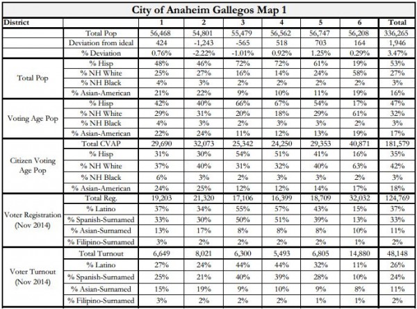
Gallegos Map — Map and Stats

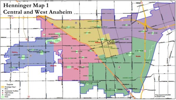
Henninger Map — Map and Stats

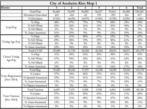
Kim Map — Map and Stats

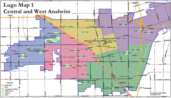
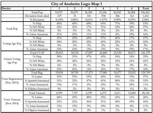
Lugo Map — Map and Stats
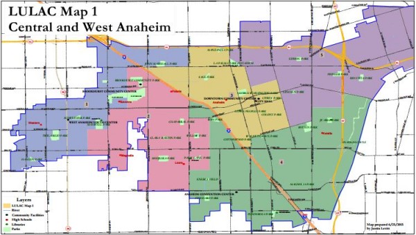
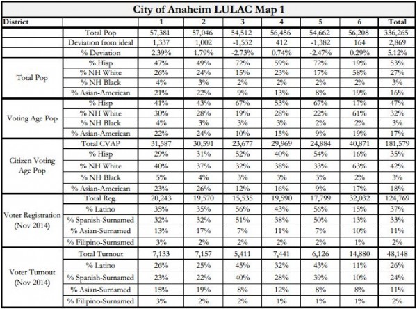
LULAC 1 Map — Map and Stats
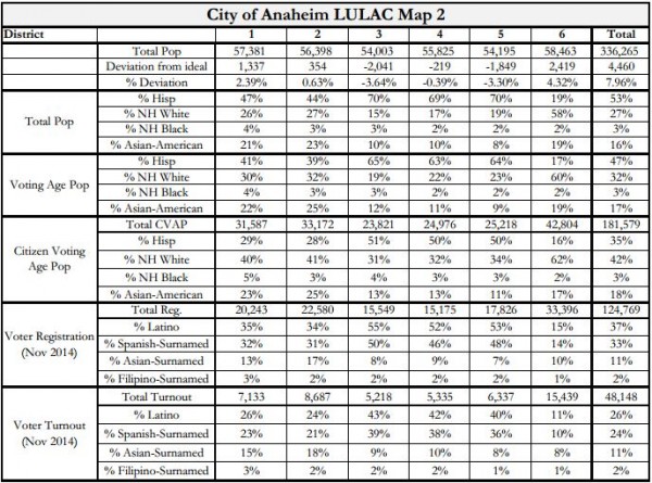
LULAC 2 Map — Map and Stats

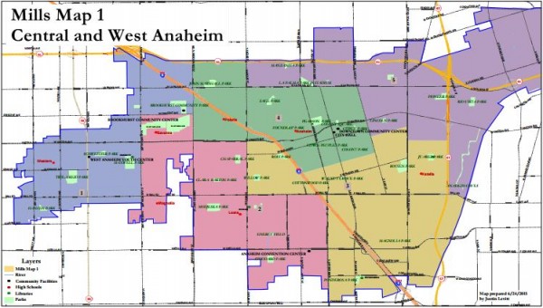
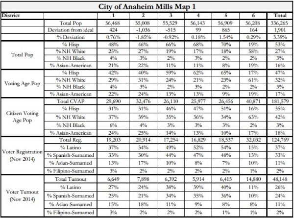
Mills 1 Map — Map and Stats
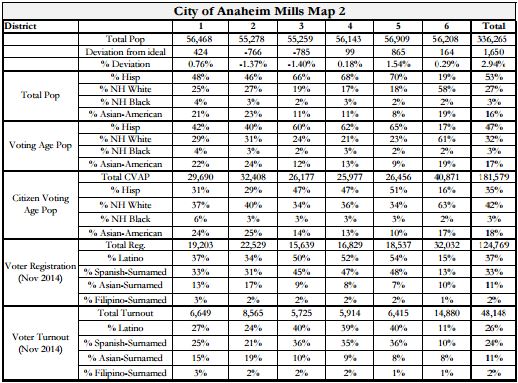
Mills 2 Map — Map and Stats

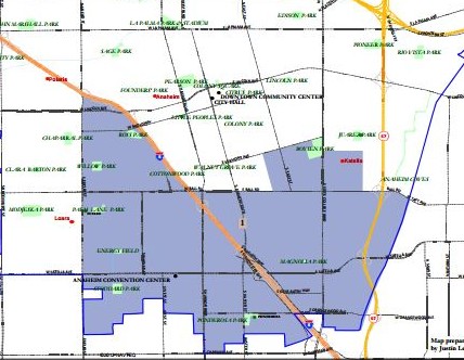
Ponderosa Communuty Partial Map — Single District Map and Stats

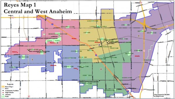
Reyes 1 Map — Map and Stats

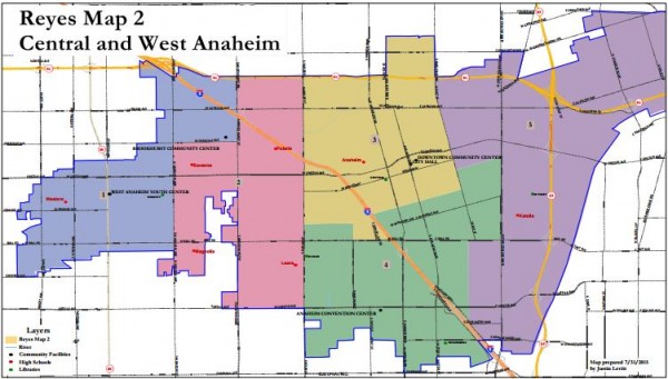
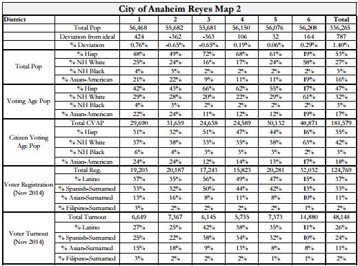
Reyes 2 Map — Map and Stats
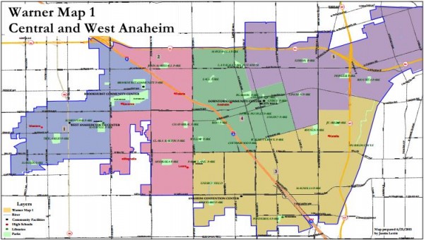
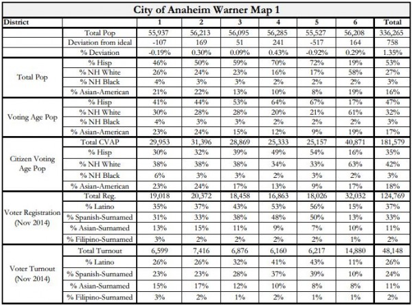
Warner Map — Map and Stats
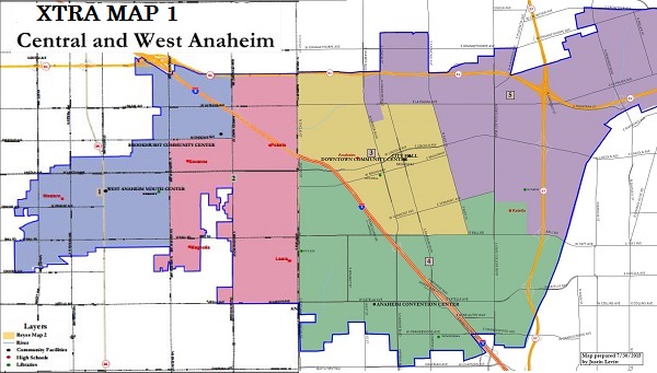
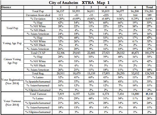
There’s one final map to consider that doesn’t actually appear on the City’s website. This is XTRA Map 1 — a hybrid of Reyes Map 2 west of Euclid and Chuchua Map 4 east of it. This matches the preferences of the Latino activists who gathered last weekend to consider what they considered their interests to be (although some maps other than Chuchua Map 4 that would satisfy their desired outcome east of Euclid.)
XTRA Map 1 — Map and Stats
Leave a Reply